
Ontario and Quebec are set to see widespread snow, rain, and ice as a complex system tracks through. These impacts will also be accompanied by gusting winds, which will interact with the wintry precipitation and could create hazardous travel conditions. More on the details and timing, below.
SUNDAY: WEEKEND SNOW PILES UP ACROSS ONTARIO AND QUEBEC
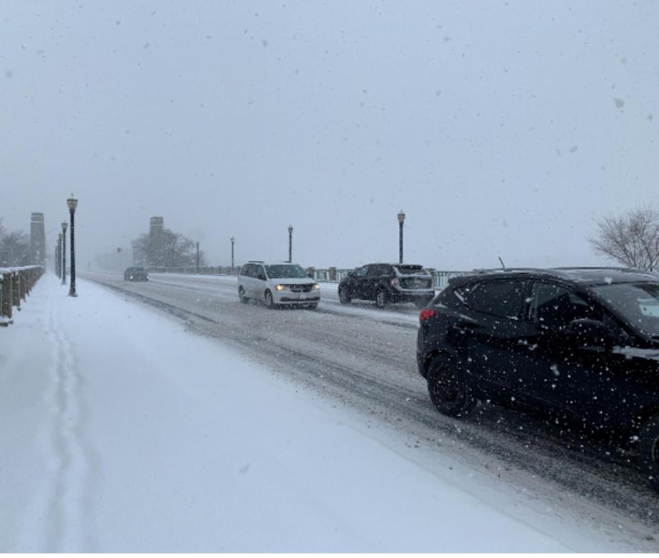
The snow that developed on Saturday evening in Ontario will taper off by Sunday morning. Across Quebec, the snowfall in Montreal and the Eastern Townships will last through Sunday evening.
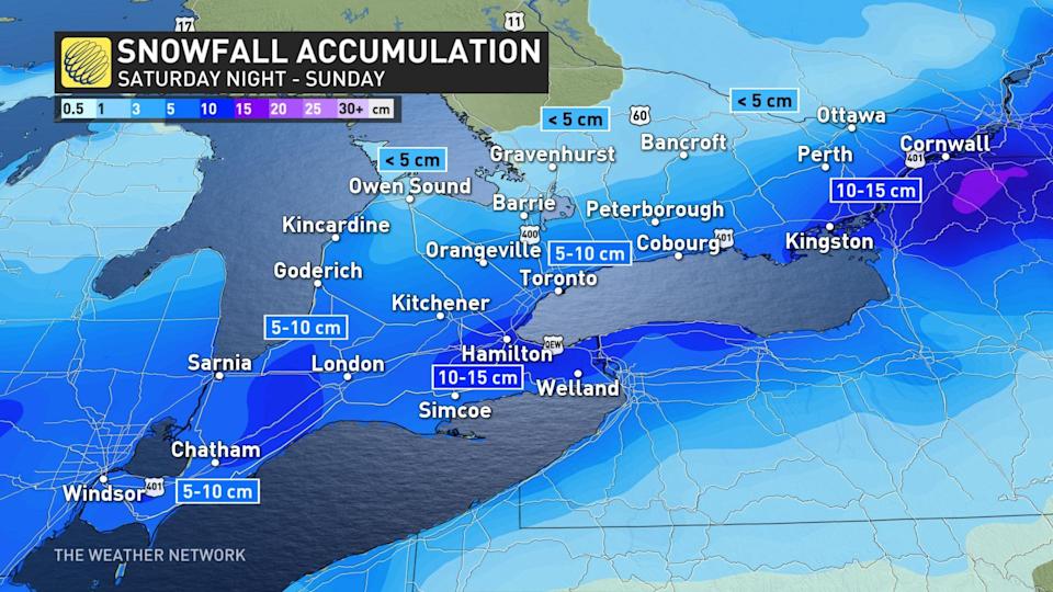
We can expect widespread snowfall accumulations of 5-15 cm across southern Ontario into southern Quebec. The western shores of Lake Erie around Hamilton, as well as areas from Kingston to Cornwall, stand to see 10-15 cm of snow. The GTA will likely have 5-10 cm on the ground by Sunday.
This snowfall will be more impactful than usual because the snow will initially melt on pavement, but the compressed slush will turn to ice as temperatures fall well below freezing into Sunday.
Blustery winds throughout the storm could make travel difficult in spots. Expect widespread wind gusts of 40-60 km/h across southern Ontario, with the highest gusts possible along the Huron shores.
CONSIDERABLE TEMPERATURE DROP IN BEHIND SYSTEMS
A quick blast of Arctic air will arrive behind the system on Sunday into Monday. Daytime highs will fall below freezing on Sunday across southern Ontario and Quebec. Gusty winds will make it feel even colder, with wind chill values reaching the minus teens at times.
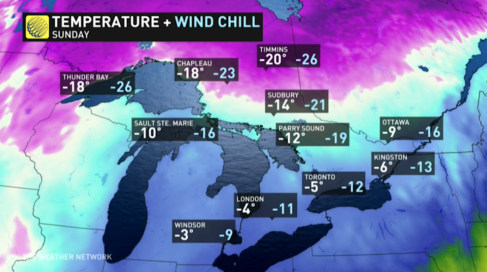
Similar temperatures are expected Monday, though it’ll be much colder in eastern Ontario and southern Quebec, with daytime highs no warmer than the minus teens, and wind chill values feeling closer to -20.
Looking ahead further, temperatures will moderate Tuesday and Wednesday, but another colder blast of Arctic air arrives late week. Variable temperatures and an active pattern are expected into the second week of January.
Check back as we continue to monitor the New Year’s forecast.